Showing posts with label National Parks. Show all posts

Sunday, November 25, 2012

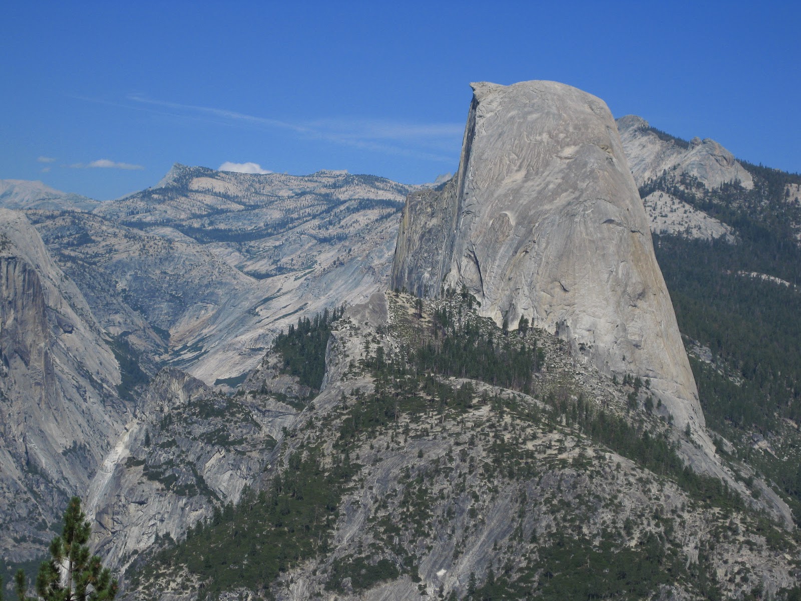
Yosemite National Park:Hike to Half Dome

The hike up Half Dome has some of the most famous and signature sites of Yosemite National Park along the way.  If you are planning to hike to the summit, the total round trip will be 17 miles and can take anywhere from 10-12 hours.   Cables are placed on the dome from May-September.  Plan to leave around 5 or 6 am to avoid any possible evening storms while on the summit.
We began at the Mist Trail to Vernal and Nevada Falls. 


If you don't want to do the entire trek to Half Dome, a nice short family hike to Vernal and Nevada Falls can be done.  Its 3 miles round trip to Vernal Falls and 7 miles round trip to Nevada Falls.  From Nevada Falls you can either go back down by the John Muir trail, or go back the way you came on the Mist Trail.  The John Muir Trail is a little easier, however longer and has horses on it.  So if you don't mind jumping the poop piles you can go this way. 

I'm sure many of you have heard about the many tragic deaths that have occurred in Yosemite this past year.  Many of them were near or on Vernal Falls.  Hikers need to have a deep respect for the water near this falls.  There are signs and fences which are ignored by many which lead to such horrific accidents.   There is a huge change in the water depending on the time of year, and also undercurrents which people are not aware of.   During my visits to Vernal Falls, look at how different it looked depending on the time of year.

Here is my visit during the fall/later summer:

Vernal Falls


Top of Vernal Falls

Looking down from the top of Vernal Falls
Here it is during the early summer:


Amazing the difference!


All that to be said, please be careful and follow the signs!  After passing Vernal Falls you will continue to hike up in elevation towards Nevada Falls. 


This is where the trail either branches off and you can go down the John Muir Trail or head back the way you came, or continue on towards Half Dome!  After Nevada Falls it will flatten out for a short period as you walk through the woods.  Its encouraging to see a sign like this for only 2 miles left, however don't be fooled!  It seems the most difficult part is yet to come!


Right before the dome is a section of steep switchbacks along the mountains edge.  I remember feeling really tired at this point and was nervous about being a little dizzy so close to the ledge of the mountain.  Make sure you have plenty of water for this part!


Surviving the Dome:
1. Gloves: leather or heavy duty with grips- not winter (cables will rip regular cotton)
2.  Mountaineering harness and clips-clip yourself to cables
3. Permit: a permit now needs to be purchased to climb Half Dome. 
4. Water: bring plenty of water or a filter.  It gets very hot on this trail!
5. Food and snacks
6. Best gripping shoes you have! The dome is slippery and steep!
7. Headlamp if you leave early
8. Poncho: if hiking early in the summer vernal falls will get you soaked!
9. Toilet paper: there are only a couple rest stops along the way.
10. Pepper spray: we ran into bear and coyote on this hike
11. Work out the arm muscles!  You are using so much upper body strength to pull yourself up the cables since your feet are slipping so much.  My arms were shaking by the time I reached the top. 

Be prepared to wait as you make your ascent up the cables.  People go at all different speeds and its important to be careful and not push people out of the way.  Many deaths are caused by people slipping without harnesses on, or being pushed off the cables.  Do not attempt to climb if there is a storm coming nearby or if it is raining.  The dome is already slippery and will be hazardous if wet.


Here's a good picture showing the wood platforms placed every 10-15 feet or so.  You can use these to rest or steady yourself on the steep incline.


This guy is using the mountaineering harness and clips.  While you would have to clip in and out at every pole, this would help to ensure you wouldn't slip off.


The summit is a flat platform with great views in all directions.  This ledge is a common photo spot.


Hope this information helps any of you waiting to attempt your first climb up Half Dome!   It has definitely been one of my favorite hikes I've done so far.


Wednesday, November 7, 2012

Best Hikes in RMNP: #1 Sky Pond


The nice thing about this hike is that you can make it more of a circular route instead of an out and back hike.   By doing this you are able to see a large portion of the area in only one hike, seeing a total of 5 lakes and 2 waterfalls!  With the bus system in Rocky Mountain National Park (RMNP) at the Bear Lake end, it doesn't matter which trailhead you come out at because the buses will bring you back to your car.  I start at the Bear Lake Trailhead and begin hiking towards Nymph, Dream, and Emerald Lake.  Both Dream and Emerald Lake are worth stopping at along the way.  Emerald Lake will be a little bit further out of your way, adding distance to the hike though.


 At Dream Lake take a left towards Lake Haiyaha.  Go straight at the turn off for Lake Haiyaha however, and then a right at the second fork towards The Loch.  Between the Loch and Sky Pond is my favorite part of this hike. 

 The Loch is a beautiful, clean glacier lake.  You hike around the lake and hike straight ahead between those peaks.

After The Loch you start inclining towards Timberline Falls. 
             

Headed up towards Timberline Falls on the far left.

You are able to hike right to the falls for a great picture, and then the trail continues to climb up right alongside it.  This is where you get a little scrambling in as you climb up the rocks to above the falls.  But don't let the scrambling scare you.  I have seen all ages on this hike- from old to really young kids with their parents trekking the whole thing.

Path climbing up towards Lake of Glass.  When the water level is high, some of the waterfall will even overflow over the path.  You do have to be a little careful here if the rocks are wet since they can get slippery.

Once on top of the Timberline Falls, they have rock and wood log paths leading to Lake of Glass and Sky Pond.

Lake of Glass


A few more rocks to climb and you will then reach the beautiful Sky Pond.  If you look really closely while you are there you may see rock climbers on the ridges.  Its a crazy site to see!


On your way back, take the first fork to the right after The Loch towards Alberta Falls.
You will pass Alberta Falls, and then follow signs towards Glacier Gorge Trailhead.
The bus will then take you back to your car at the park n ride.

So if you are planning a trip to Colorado for next summer, make sure you add this hike to your list!  Hope you get a chance to enjoy the hike to Sky Pond!


Saturday, August 18, 2012

Take A Hike: Perimeter Trail

While Ryan was at Badger Boy State this year, I spent a week is Colorado with my family at our favorite spot in Ouray.  We rented a Jeep from the KOA for one day and took Imogene Pass to Telluride. 
But we also went on a couple great new hikes that I want to share with you.  The Perimeter Trail is one that the city has been working on expanding over the last couple of years.  The goal is to give a scenic view from above around the entire city of Ouray.  It starts at the north end of town, right across from the visitor center and Hot Springs pool.  It is easy to follow and well marked with signs.
I think it is really neat how they carved out areas in the side of the mountain for the trail, and it has amazing views along the way. 
It goes past Cascade Falls and continue around the city over Box Canyon Falls.  You do not need to pay to continue over Box Canyon unless you want to go down into the canyon itself, then there is a small fee.  To get through the area where the canyon had been blocked off, they made a tunnel and steps on the other side with a railing.  If it is your first time to Ouray, I think it is a great trail to start off with to get you used to hiking in the elevation.  You will end up back in the parking lot of the hot springs/visitor center.  Happy Hiking!